A driver's guide to Hawaii's most iconic road trip
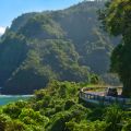
The route winds along the eastern shore of Maui, taking in verdant forests, waterfalls and photo-worthy ocean views. On the map, it’s just 45 miles between the towns of Paia and Hana, but between the curves, the more than 50 one-lane bridges and the numerous scenic stops, it’s a route that deserves at least two to three hours to truly enjoy, plus a couple more hours for the return trip, or a continuation around the island’s southern coast. Better yet, plan for a full day, which will leave plenty of time to stop and take in the sights.
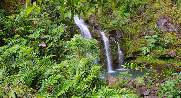
There are 50 bridges along the Hana Highway, many of which are one-lane wide. Each bridges a stream, and many provide drive-up viewing of waterfalls and pools. Photo: iStock
Soon after leaving Paia, you will pass by Hookipa Beach Park. This site draws some of the world’s best windsurfers and kite boarders, and if the riders are out, it might be worth a brief stop to watch the action. A more popular stop comes five miles later at the Huelo Lookout, where the site’s namesake fruit stand serves up refreshing fresh fruit smoothies. Also worth a stop is the Waikamoi Nature Trail, where passengers can stretch their legs on a mile- long trail that winds through eucalyptus and bamboo groves to reach a scenic overlook.
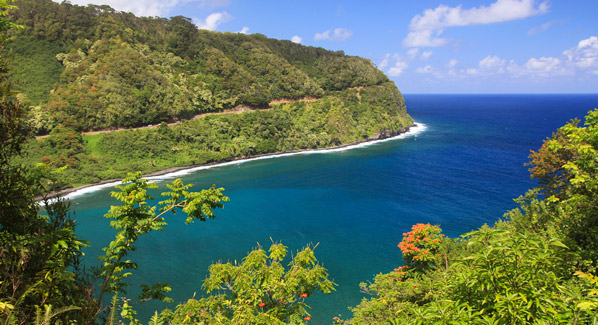
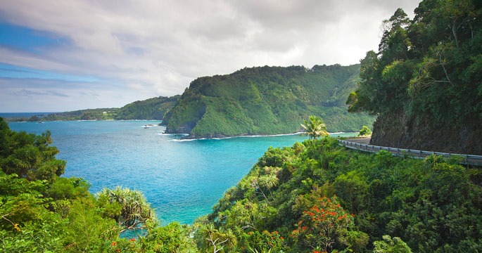
At several points along Maui’s eastern shore, the road to Hana hugs the island’s shoreline, providing drivers and passengers with sweeping ocean views. Photo: iStock
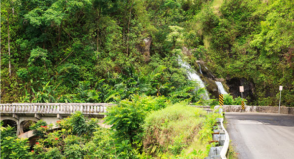
A must-do side trip comes after mile marker 16, where Keanae Road branches off to the east for a short detour to deliver sweeping views of surf- washed black lava cliffs. This side road also leads to Aunty Sandy’s Banana Bread, which is famous for it’s namesake confection. Back on the main highway, you will pass through a series of valleys, each cut by a stream that is spanned by one of the route’s signature narrow bridges. This region holds a number of scenic waterfalls, each of which will tempt you to pause and fill your smart phone’s memory card with snapshots. If there is room to park near the bridge, adventurous hikers can negotiate a somewhat steep path to Wailuaiki Falls. An easier opportunity comes a half-mile farther on at Puaa Kaa State Wayside Park, where a short trail leads to waterfalls where swimmers can take a refreshing dip in the pool below. There’s one more must-do on the waterfall photos circuit just past mile marker 19, where Three Bears Falls cascades into a turquoise pool that can be seen from the highway bridge.
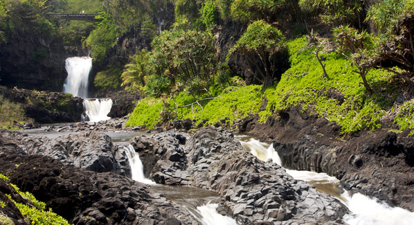
Upper Waikani Falls, also known as the Three Bears Falls, is a typical stopping point along the Hana Highway. The pool below the falls is a popular swimming spot. Photo: iStock
There are several more stops worth considering before you get to the town of Hana. Fresh juices, local coffees and baked treats await at the Nahiku Marketplace. Ka’eleku Cave is Maui’s largest and most accessible lava tube. Visitors are provided with flashlights to explore the cool interior of this cavern, and a marked pathway leads through the underground to unique geological formations. Near mile marker 31, the National Tropical Botanical Garden provides a chance to visit the sprawling ruins of Piilanihale Heiau, which is the largest ancient temple in the islands of Hawaii.
Mile 32 brings you to the town of Hana, but not the end of your road trip. A visit to this small village is a step back in time to the island’s bucolic roots. By now, it’s probably lunchtime, and you have options. The Hana Ranch Restaurant is a long time favorite, and The Preserve serves up authentic regional Hawaiian dishes. Vegans and vegetarians will enjoy Coconut Glen’s, and Huli Huli Chicken serves up a tasty version of its namesake dish. If a sit- down isn’t in order, there are usually a number of food trucks parked along the roadway near “downtown.”
If you turn around after touring Hana, you will be missing some of the route’s best sights. Hamoa Beach and Koki Beach are worth a stop, and a ten-mile drive brings you to one of the most-photographed waterfalls in Hawaii. The stream that flows from the heights of Mount Haleakala through the Oheo Gulch forms the cascades known as Seven Sacred Pools. The more adventurous will find a way to scramble down to the water. Otherwise, there are several viewpoints close to the bridge where you can snap some photos of the pools.
The cascades known as the Seven Sacred Pools are visible from the highway. More adventurous travelers follow a hillside path that leads down to the pools below. Photo: iStock
Many drivers turn around at the Oheo Gulch and retrace their route. Often, this is done in response to warnings from rental car companies that continuing past Lelekea Bay on the route known as the Piilani Highway will void the rental contract. In reality, this means that they may not provide roadside breakdown service on this more remote section of highway. There are a few short sections where the pavement gives way to dirt, but this section of the roadway is actually quite passible. As the highway passes into the rain shadow of two-mile-high Mount Haleakala, tropical greenery is replaced by grasslands, then rocky plains where only the hardiest of plants grow on the arid slopes.
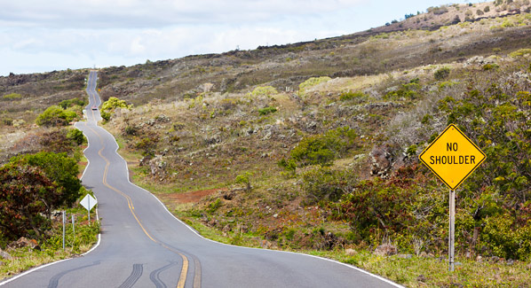
Miles beyond the town of Hana, the roadway that continues around Maui’s southern coast passes through the arid lower slopes of Mount Haleakala. Photo: Michael Utech/iStock
Around the 41-mile mark, a short side road leads to the historic Palapala Hoomau Church, which is the site of Charles Lindbergh’s grave. The road then leads into ranch country, and by the time you finish rounding the island’s southern coast and make your way back north along the shoulder of Mount Haleakala, afternoon will likely turn to dusk. This is a good time to pause and take in sunset views from an elevation of 2,000 feet above the Pacific Ocean