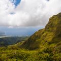
Panoramic views await those who scramble up Subi Brandaris, the island's highest hill
You’ll want to get an early start to reach the highest point on Bonaire. The climb up the hill known as Subi Brandaris won’t take all day – more like 45 minutes to an hour each way for most—but it’s best to start in the cool of the morning. Plan on arriving at the entrance gate to Washington Slagbaai National Park right at the eight o’clock opening hour, wearing sturdy walking shoes and packing drinking water and sunscreen. Let the rangers know your plans, and follow the park’s dirt roads some two miles to the trailhead parking area.
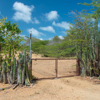
In a land where fencepost-sized trees are scarce and slow growing, the resourceful farmers of Bonaire plant rows of cactus to create boundaries and contain livestock. Photo: Frank van den Bergh/iStock
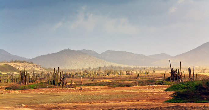
The trip to the summit begins in a grove of small hardwoods. A well- worn path offers partial shade for the first quarter mile, plus a chance to scan the branches for signs of the Bonaire parakeet and the many other species of birds that flit about the park. The vegetation thins and adds the odd cactus as you break out onto a boulder-and-scrub-covered ridge, which is bisected by a fence. This is the dividing line between the two former plantations—Washington and Slagbaai—which were combined to create the national park some 50 years ago. Fields where aloe and kadushi cactus were once cultivated have returned to more native vegetation, and there are ongoing efforts to remove the now-feral goats and donkeys that are descendants of the original farm animals. A gate on the pathway keeps goats out of the lusher Slagbaai side of the park, which has been purged of these over-grazing animals. Be sure to re-close it after passing through.
At the crest of the lower slope, you’ll turn west and traverse a ridgeline that provides valley views in two directions, as well as the rising summit of Brandaris ahead. At this point, the route begins a transition from path to boulder field, and as the ascent continues, you may find yourself having to scramble up and over couch-sized rocks, using the occasional handhold to steady yourself. It’s not quite rock climbing, but more challenging than your average nature walk. The higher you climb, the fresher the breeze, as you are now above the surrounding hills that blocked the easterly trade winds in the lower areas of the park. Up here, the branches of solitary divi trees grow at right angles, attesting to the relentless influence of the wind. Hang on to your hat, lest it be launched over the edge.
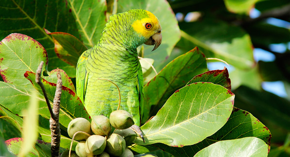
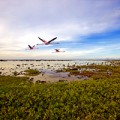
A Yellow-shouldered parrot roosts near one of the seasonal waterholes in Bonaire’s Washington Slagbaai National Park. The island attracts more than 200 species of birds. Photo: Brian Lasenby/iStock
You actually won’t mind the breeze, because it mitigates the growing strengthening of the sun and wicks away the light sweat generated by the climb. You come upon an iguana, sunning itself on a ledge, barely acknowledging your upward efforts. By now, the only remaining semblance of a trail is a series of yellow blaze marks painted on bushes and boulders, indicating the easiest route through the rocky maze. But the way on is obvious, and a few minutes later, you reach the white summit marker, which sits 784 feet above sea level.
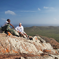
Hikers pause at the windswept summit of Subi Brandaris, the highest point on the island of Bonaire. This vantage point provides 360-degrees of the island and the Caribbean Sea. Photo: Justin Lewis
The bare, windswept summit provides panoramic views of the park and the Caribbean Sea beyond. In clear weather, you can make out the distant outlines of the island of Curaçao and the Venezuelan mainland. The wind and the views somehow make Brandaris seem much higher than its sub-800-foot elevation; it’s as if you are standing on a peak miles high in the Rockies or the Alps, with the world falling away below you. Linger a few moments to take it all in while watching hawks riding the air currents.
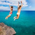
The way down will be a bit quicker, though you’ll still need to mind your step, and you’ll be glad you packed plenty of water by the time you reach the base of this dry route. Well before noon, you’ll be back at your car, ready to decide if the afternoon should include a swim off one of the park’s remote beaches, a daring leap into the ocean from the cliff face at Boka Slagbaai or a drive into the nearby town of Rincon for some home cooking at the Rose Inn.