Fire and Water: A Big Island road trip showcases the volcanic forces of nature
Any visit to the Big Island should include at least a day spent discovering the island’s fiery origins, and nature’s amazing transformation of ash wastelands into verdant rainforest. All of this and more can be seen with a day of road tripping along the island’s southeastern coast, with plenty of interesting stops, short hikes and maybe even a swim along the way.
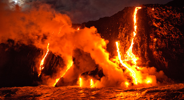
A night scene of molten lava seeping from underground fissures to meet the cooling waters of the Pacific. The hot flow will solidify to create new land. Photo: iStock
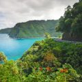
The trip begins in Hilo, where Highway 11 leads into the area known as the Puna District. A right turn onto Highway 130 takes you through an orchid farm to historic village of Pahoa, where you can stock up on fresh fruits grown in the region’s rich volcanic soil. Follow route 132 to begin the 12- mile scenic drive along the coast that offers many reasons to stop.
A favorite stop is the lighthouse at Cape Kumukahi, which is Hawaii’s easternmost point. A scientific monitoring station located on the point has shown that the easterly winds that wash the point are the cleanest air in the world.
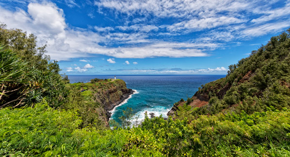
The lighthouse at Cape Kumukahi sits at the easternmost point in the Hawaiian Islands, with sea breezes that bring what is said to be the freshest air in the world. Photo: iStock
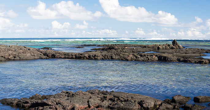
After taking in the big view of sea, sky and breaking surf, stop by the nearby beach to watch body surfers challenge the breakers. Leave the big waves to the experts, as you have two excellent chances to get wet just down the road. First up are the Waiopae Tidepools, which offer clear, fish filled shallows, sheltered from the waves. A half-mile down the road is the thermal pools at Ahalanui Park, where sulphur water heated by volcanic vents provides a relaxing soak.
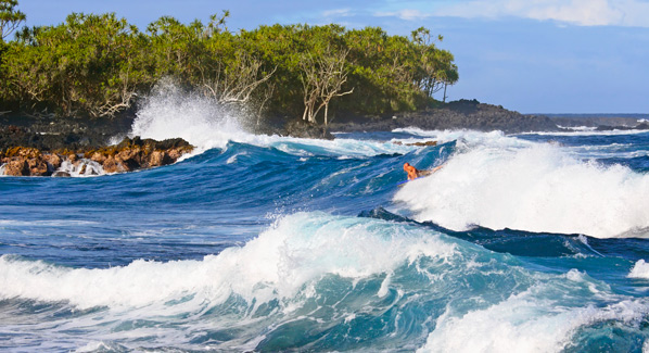
A body boarder challenges breaking surf in a rock-bound cove near Cape Kumukahi, which is the easternmost point in the Hawaiian Islands. Photo: iStock
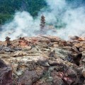
The highway hugs the shore, passing two more beach parks and the site of Kalapana. This coastal hamlet was partially covered by a lava flow in 1990, and at a coastal overlook you can still see steam rising from an active vent where hot magma meets the cooling waters of the Pacific. If time permits, Lava Tree State Park offers a short hike through unique formations formed when lava flowed over trees, creating enduring stone replicas of their trunks.
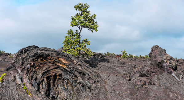
Trees grow in black lava at the Hawaii Volcanoes National Park. Over time, their roots will begin to break down the rock to create fertile topsoil. Photo: iStock
A return to Highway 11 will bring you to the artists’ community of Volcano Village, an oasis of rainforest green just outside the entrance to Hawaii Volcanoes National Park. It’s a good place to grab a bite and top off the tank before heading into the park. At first, the park’s Crater Rim road remains cloaked in greenery. The scenery changes as you pull off at Kilauea Overlook, and survey the vast tracts of cinder and blackened rock that drop into Kilauea Iki Crater. There is a four- mile trail that descends into the Crater, then climbs the opposite rim, but you’d need study shoes, plenty of water and sun protection to take that on.
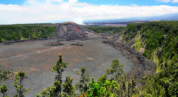
The green-clad upper rim of Kilauea Iki Crater provides a stark contract to the interior, which is a realm of cinder and ash, with steaming phosphorous vents. Photo: iStock
Instead, take a relaxing walk along the crater rim, and then make a short drive to another overlook that gives access to the Thurston Lava Tube. A lava tube is the solidified remains of what was once a flowing underground river of molten rock. Some stretch for miles, but the Thurston cave is relatively short, and has lighting and walkways that make exploration easy.
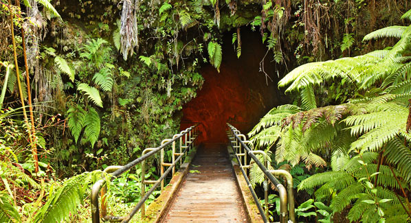
A walkway leads to the entrance of the Thurston Lava Tubes in Hawaii Volcanoes National Park. Inside, stairs lead down to a lit passage where lava once flowed. Photo: iStock
By now, it’s probably getting on toward late afternoon, but there’s still time to take in one more sight. Continue southward onto the Chain of Craters Road, which winds through a barren landscape of black lava rock. But even here, there are signs of life. Grasses and ferns grow through cracks in the lava. Lone Aalii and Ohi’a Lehua trees stand like solitary sentinels, their roots probing crevices in the rock for pockets of water, and slowly but inexorably turning rock into gravel, then soil.
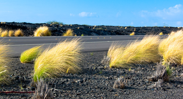
Tufts of grass sprout from fields of black volcanic ash along the shoulders of the Chain of Craters Road in Hawaii Volcanoes National Park. Photo: iStock
Over the years, this road has been repeatedly covered by lava flows. It is once again open, and leads to the sea. Before it was covered in flowing lava, this coast was once rich farmland, and the site of sacred temples. Today, it provides a dramatic lesson of how this island chain was formed. Visitors who make it to the coast are standing on some of the youngest land in the world.
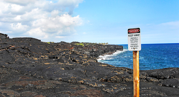
The Chain of Craters Road leads across desolate lava flows to end of the coast, where surf crashes against some of the youngest land in the world. Photo: iStock