Tag Archives: Plan

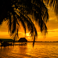
Bocas Del Toro Sunset Panama

Panama Snapshots: Almirante Bay


On Panama’s northeastern coast, the sheltered waters of Bahia Almirante separate the mainland from the islands of Bocas Del Toro. In addition to the nine primary islands, this archipelago includes dozens of smaller cays and hundreds of green-clad islets. Some are settled by native fishermen, who inhabit stilt homes built over the water. Others are home to secluded off- grid resorts, where guests immerse themselves in one of the world’s most bio-diverse ecosystems. There are few roads, and small taxi boats connect the islands.

The entire area is a UNESCO World Heritage Site, as well as Panama’s first National Marine Park. Though not on the mainstream tourism radar, this area gets its share of adventurous travelers. Some come to surf or dive the reefs, others simply wish to experience nature at its most pristine.

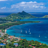
Carriacou

Caribbean Snapshots: Carriacou


Carriacou is a “just right” island. There are no high-rise hotels or mega resorts overshadowing the beaches, just quaint guesthouses tucked into the green hills. Instead of swarming cruise ship crowds, the waterfront is a casual mix of local fishermen and visiting yachtsmen. It’s been called the friendliest island in the Caribbean, where laid-back locals welcome the off- the-beaten-path travelers who arrive by private boat, small plane or a ferry from Grenada.

This 13-square mile dollop of green provides scenic hikes that lead to hilltop vistas, or down to a stunning collection of white, golden and black sand beaches. Snorkel-worthy coral reefs lie just beyond the turquoise shallows, along with a smattering of tiny offshore islands and sandbars perfect for beach combing getaways.

Carriacou is also known for its rum shops, with more than 100 small taverns scattered through neighborhoods and villages. Most concoct their own house blends from a potent stock known as Jack Iron. The afternoon toddy is a long-standing island tradition, which may help explain why everyone seems so relaxed and friendly.

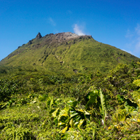
Guadeloupe La Soufriere Volcano

Walk This Way: Guadeloupe’s Amazing Volcano Hike


Pick the right day and a hike up Guadeloupe’s La Grande Soufriere will reward your uphill efforts with grand views of island and ocean from a height of 4,800 feet. But even if the clouds roll in and take away the big picture, you’ll still find yourself immersed in a lush tropical forest on the lower slopes, and an otherworldly landscape of lava flows and steaming sulfurous vents at the summit. In fact, this mountain’s name translates from French as “big sulphur outlet, and it is one of the youngest and most active volcanoes in the Caribbean. Relax, it’s not likely to blow without warning, the last eruption in 1976 didn’t cause any loss of life.

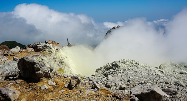
Guadeloupe La Soufriere Crater

Clouds of sulfur-tinged steam rise from a thermal vent in the south crater of La Soufrière. This volcano last erupted in 1976, and is one of the youngest in the Caribbean. Photo: Jean-Luc Azou/iStock

In years past, it was possible to drive to within 1,000 feet of the summit, but a closure of the road leading up to the sulphur mine at Savannah Mulets means you’ll have to hoof it up on the network of trails that both circle and ascend the slopes. If you want to go all the way to the top, plan on a couple of hours of walking on a route that circles the volcano as it climbs. Most of the route offers moderate grades, with a steeper section near the top. Along the way you will alternate between areas of verdant greenery and lava flows where the flora is once again taking hold. Up top, you’ll find evidence of historic eruptions, as well as active fumaroles—vents that spew clouds of odiferous sulphur gas. Your greatest challenge when hiking Soufrière won’t be the climb, it will be picking a day when the clouds are at bay and there’s a clear view from the top. When conditions look favorable, put on some sturdy shoes, pack water and snacks, and get ready for a real adventure.

Martinique llet Madame

Caribbean Snapshots: Ilet Madame, Martinique


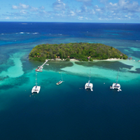
There’s no better way to go off the grid than spending a day exploring uninhabited islands. On the east coast of Martinique, finding your own little offshore paradise is as easy as traveling to the fishing village of Le Robert. At the head of the township’s namesake bay lies a collection of sandbars, reefs and 10 small islands that form an aquatic playground for sailors, paddlers and swimmers. One of the largest and most favored of this group is Islet Madame. Yachtsmen from around the island of Martinique are lured to the calm anchorage that lies just off this small, green spit of land, while day visitors make their way over in private launches from the township of Le Robert.

The island is a protected refuge ringed by white sand beaches and surrounded by translucent waters where coral reefs create calm lagoons. Getting there is easy, as a number of tour operators offer sailing and powerboat excursions to the islands. A few adventurous locals even wade and swim a quarter mile over from Pointe La Rose.

Once there visitors find spectacular snorkeling, kayaking and swimming. On shore, there are paths to follow through the foliage, plenty of shaded areas and some local wooden huts to provide shelter from the elements. The island is prized for its collection of native tree species and protected animals, including iguanas, lizards, birds, hummingbirds and turtles. The scene is low-key though the week, while weekends may bring local boaters, who gather for a raft-up party at one of the nearby sandbars known as le Fonds Blanc. Visitors have described these islands as among the most beautiful in the entire Caribbean. If you are on Martinique, it’s a destination that shouldn’t be missed.

Hawaiian Shirts

The Original Hawaiian Shirt


Like the islands themselves, the modern-day Hawaiian shirt is the product of a mixing pot of cultures and traditions. The colorful, casual designs of today represent a convergence of influences, with its deepest roots in the colorful patterns of kapa cloth. This traditional Hawaiian fabric was usually dyed in bold geometric patterns, and worn as loincloths known as kapa malo, or sarong-like wraps known as kapa pa’u.

The arrival of European missionaries heralded a new era of conservative western-style dress through much of the 19th century, but dress codes began to relax and expand in the early 20th century, when migrants from the east came to work the sugar plantations and pineapple fields. The Chinese brought brightly colored and loose fitting silk garments, while workers from the Philippines favored the relaxed feel of the untucked and cool-wearing barong tagalog. At around the same time, Japanese immigrants transformed the cooling fabrics and loose fitting style of the kimono into a short-sleeved work shirt that would become known as the palaka. The traditional palaka sported a checkerboard design, but it wasn’t long before the cultural mingling lead to bold new interpretations that also tied into Hawaiian kapa cloth designs.

Most historians give credit to a merchant named Ellery Chun for popularizing the first modern version of what we now call the Hawaiian shirt. In the 1930s, his dry goods store in Honolulu began selling a garment he labeled the Aloha Shirt. It wasn’t long before other tailors began creating their own versions of these loose-fitting, brightly colored shirts. As the first wave of vacationers arrived from the United States, many returned home with bright Hawaiian shirts as reminders of their time in the islands.

Following World War II, the Hawaiian shirt became the unofficial symbol of a new cultural attitude that embraced a more relaxed dress code and lifestyle, and these shirts would eventually become accented business attire. Hollywood popularized the style, and by the 1960s, the Hawaiian shirt had made its way into mainstream American culture. There have been a number of subtle variations in style, materials and colors in the years since, but one thing remains unchanged: put on a Hawaiian shirt, and you are almost guaranteed to take life just a little bit easier.



Tortola Long Bay Beach

Caribbean Snapshots: Long Bay Beach, Tortola, BVI


Though you may hear locals refer to it as the “big island,” Tortola is actually just 12 miles long by three miles wide. The nickname may have as much to do with the island’s role as the British Virgin’s hub of government and commercial activity. But if you hike the forested slopes, drive the coastline or explore hidden coves by boat, its 22-square-miles can seem larger than the statistics would suggest. Scattered across this landscape are a collection of vacation villas and boutique hotels that provide a relaxing retreat, or a base for daily adventures to area beaches and nearby islands.

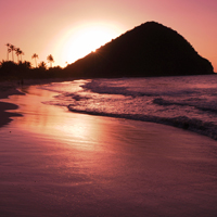
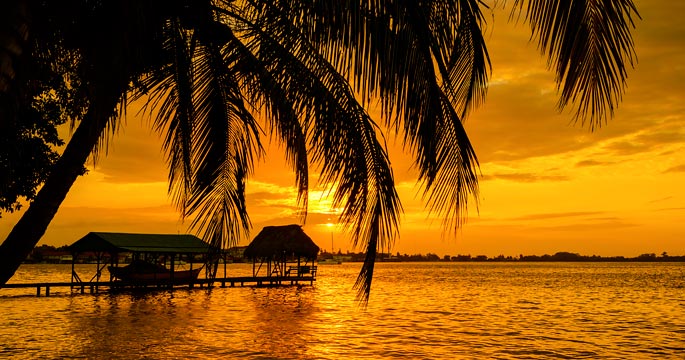
One of Tortola’s best stretches of white sand is Long Bay Beach. Located on the island’s north shore, the mile-long swath of sugar- fine granules is ideal for swimming, beach walks or just relaxing. Never crowded, there’s always plenty of room to stretch out a towel or borrow beach chairs from Long Bay Beach Resort, which offers hillside suites with views of Jost van Dyke. The resort bar and restaurant are within easy reach of the beach, providing a break from the sun and a welcoming spot for lunch or cocktails. Picturesque and calm, the bay is dotted with sailboats and flanked by palm trees that offer a cool bit of shade. Come sundown the vibrant blues of the water and the dazzling white of the sand transition to pinks and oranges, providing a mellowing cast to the scene just in time for happy hour.

costa rica waterfalls, llano de cortes

Costa Rica Waterfalls: Llanos del Cortez, Bagaces, Costa Rica


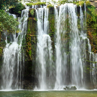
Costa Rica’s Llanos del Cortez has all the elements you look for in a tropical waterfall, including lush foliage, a dramatic drop and a pool of cool, clear water at the base that’s perfect for a swim. And there’s one more thing; this waterfall has what many would consider a “just right” location. Getting there doesn’t require a long, arduous hike on muddy or steep jungle paths. But on the other hand, you can’t just step off the tour bus and jump in.

Just west of the town of Bagaces, in the country’s north-central highlands, a bumpy but passible dirt road branches from the Pan American Highway. Unobtrusive signs direct you to a simple parking area, where it is customary to make a small donation that supports local schools. From there, it’s a short but slightly steep walk down the bank to the base of the falls, where you will find a sandy beach and—if you’ve come mid week and mid morning—few other people. The water is refreshing but not cold. You’ll want to swim over to the base of the falls, where you can immerse yourself in the gently falling water, or duck behind the wispy liquid curtain into a cool grotto.

Costa Rica Cloud Forest

Walk This Way: Monteverde Cloud Forest, Costa Rica


High in Costa Rica’s Tilaran Mountains, the air is cool and crisp and the trees are laden with bromeliads and shrouded in mist. This is the Monteverde Cloud Forest Preserve, home to jaguars, ocelots and the resplendent quetzal, considered to be the most beautiful bird in the Western Hemisphere.

Nature lovers will be pleased to know that the park provides habitat to over 100 species of mammals, 400 species of birds, 120 species of reptiles and over 3,000 species of plants, including some 500 types of orchids. On all, the preserve supports four different bioclimatic communities.

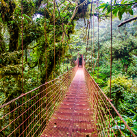
A highlight of any visit to the preserve is a trek on the Sky Walk. This series of suspension bridges and walking trails allows visitors to witness the complex life of the rainforest canopy at close range. High in the treetops, vines and thick mosses grow among the branches. This is where 90 percent of the area’s biodiversity is found. To give visitors a closer look at this elevated realm, six bridges are strung between towering trees, the longest spanning 984 feet. Down below are over a mile and half of additional trails weaving throughout the verdant jungle growth.

Two-hour tours are offered at scheduled times during the day, with guides on hand to point out native plants and animals. Those wanting to explore on their own can follow maps to observation areas, waterfalls and rivers.

Big Island Rainbow Falls

Hawaiian Waterfalls, Rainbow Falls, Hawaii


Near the town of Hilo, on the big island’s eastern shore, the Wailuku River takes an 80-foot plunge into a frothy pool shrouded in greenery. In morning light, mist rising from this pool refracts sunlight into shimmering spectrums of the rainbow. The Hawaiian people dubbed this light show, Waianuenue, which translates to Rainbow Falls.

This is not only one of Hawaii’s most popular waterfalls, it is also one of the easiest to reach. There’s no hiking or climbing involved, as Rainbow Falls is located just minutes from downtown Hilo within Wailuku River State Park, with a road leading right up to the overlook. After taking in the sights, you can continue a mile up the road to another landmark Peepee Falls, where a series of terraced pools known as the Boiling Pots bubble like a caldron over the fire. From resorts on the Kona area, it’s a two-hour drive to Hilo and the falls, which makes it an ideal day trip.