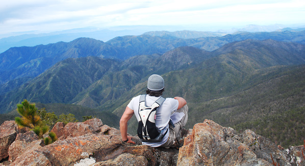
For some, it’s enough to admire a cloud shrouded Caribbean peak from the comfort of a beach chair. But for those up for a challenge, a day hike to the high point of the island can make for a life list adventure. There are a number of peaks in the region that are worthy of being called mountains, some soaring a mile or more above the ocean below. Here are five of the best climbs in the Caribbean.
Guadeloupe, La Soufrière
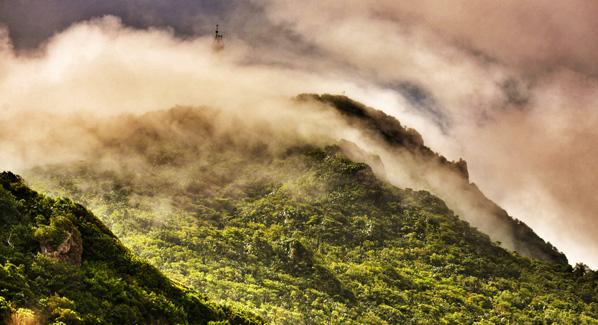
Guadeloupe’s Basse-Terre island is a land of rainforest-clad slopes, waterfalls, bubbling hot springs and remote forest glens that are home to more than 270 species of birds. Rising above it all is the imposing silhouette of La Soufrière Volcano, which reaches a height of 4,800 feet above the Caribbean. This semi-active volcano last erupted in 1976, and has been simmering away quietly ever since. Reaching the summit is no stroll in the park, but it’s also not as difficult as one might imagine. A road leads up the slope to a parking area set on the flanks of the volcano at an elevation of 3,100 feet. From this starting point, it takes most hikers a bit less than two hours to climb the remaining 1,700 feet to the top. The way up begins as a footpath, but turns into more of a scramble near the summit. Along the way, rainforest slopes turn to stunted groves, then lava fields where underground vents known as fumaroles release sulphur-laded steam. Depending on the day, the peak may be shrouded in clouds, or provide panoramic island views. In either case, the most fascinating sight is a look into the alien-like landscape of the inner crater, where a wide crevice known as Hells Gate releases clouds of smoke and steam.
A narrow road leads half way to the summit of Guadeloupe’s La Soufrière Volcano. From there, it takes hikers about two hours to make their way to the top on a trail that winds it’s way around the slope. Photo: Guadeloupe Islands Tourist Board
Dominican Republic, Pico Duarte
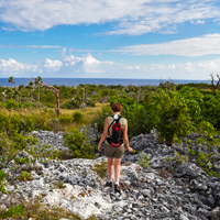
Reaching the highest peak in the Caribbean isn’t something you can do in a day. But if you have two or three days to spare, an ascent of Pico Duarte is a life-list experience. Climbs usually begin in the foothills of the Armando Bermúdez National Park, and follow a 15-mile route along the northern slope of the mountain. Hikers are required to hire the services of a local guide, who uses pack mules to carry food and camping gear. Day one of the trek involves a steady but manageable climb from an elevation of 4,000 feet to a campsite at 8,000 feet. Along the way, walkers follow flowing streams, and pass through three climates zones. Day two is devoted to ascending the final 2,000 feet to arrive at the summit, which is nearly two miles above sea level. Some ambitious walkers will make the entire return trip on this same day, while others extend the excursion with a second night of camping, and more time at the top.
A view from the summit of Pico Duarte, which is the highest mountain in the Dominican Republic, and the entire Caribbean. Photo: Dominican Republic Ministry of Tourism
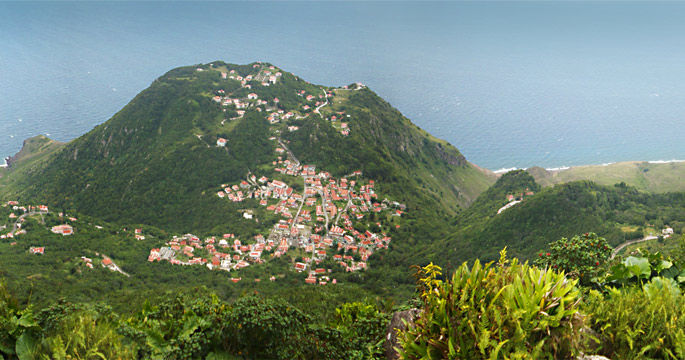
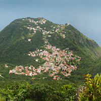
Saba, Mount Scenery
If you want to reach the highest point in the Kingdom of the Netherlands, don’t book a flight for Amsterdam. Instead, take the puddle jumper from St. Martin to the small island of Saba, which remains a special municipality of the Kingdom. Book a room at one of the small guest houses that perch midway up the slopes of the extinct volcano that forms the island, and lace up your hiking shoes for a workout that includes more than 1,000 hand- made stairs as part of the trail that climbs to the 2,855-foot summit of Mount Scenery. Plan on an hour and a half for the trip up, which will leave time along the way to take in the unique flora of the elfin cloud forest, where centuries-old mountain mahogany trees are smothered in orchids and bromeliads. Plan to start your ascent by mid morning to arrive by noon, which is often the time when clouds part to provide the best views of island and ocean.
The higher elevations of Saba’s Mount Scenery are home to one of the Caribbean’s only cloud forests. Here mahogany trees and giant ferns thrive in the mist-shrouded slopes. Photo: Kai Wulf/Flickr
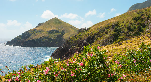
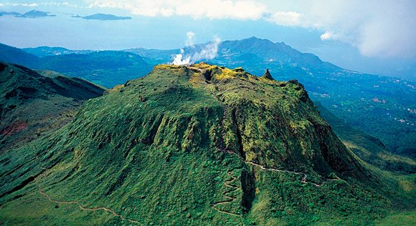
Martinique, Mount Pelée
The Caribbean’s most notorious volcano took out an entire town when it belched forth a cloud of deadly gas in 1902. Today, Mount Pelée is a slumbering giant, and tropical foliage has regrown to mask the fields of volcanic ash that once clad the side of this 4,400-foot peak. Hikers have several choices when ascending the cone. The easiest is the Grande Savane trail, which is a two-mile route that begins at mid-mountain on the sunny western slope and entails a 1,800-foot climb. Also popular is the Ajoupa Bouillion hike, which is a seven mile round trip that winds up at the eastern side of the volcano, providing climbers with cooling trade winds and a better chance of clear weather which begins north of Morne-Rouge. A volcano museum near the start of this route in the town showcases artifacts and models of volcanic events. Most challenging is the trail from Grand Riviere, which starts at sea level and makes a five-mile ascent on the northern face. All three trails converge near the top, where it is possible to descend into the inner caldera, which is covered in thickets of giant ferns.
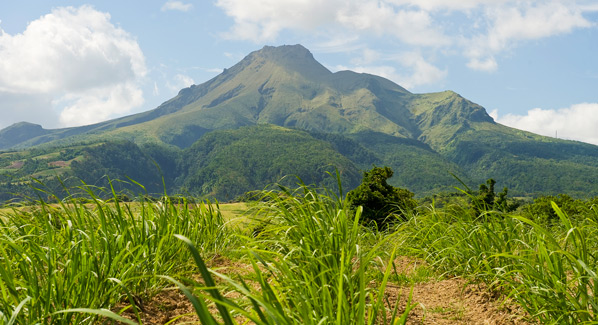
On the northern end of Martinique, Mount Pelée dominates the island’s landscape. Trees have regrown on slopes that were covered in ash and lava by the eruption of 1902. Photo: Luc Olivier/Martinique Promotion Bureau
St. Kitts, Mount Liamuiga
The interior hills and mountains of St. Kitts lie within a protected nature preserve. This provides numerous hiking opportunities on wooded slopes, and the island’s signature route is a climb up Mount Liamuiga. The route is just two and a half miles long, during which you will climb from a starting point at 2,000 feet above sea level to a ridge rising to an elevation of 3,800 feet. But its not the distance or the elevation gain that makes this a somewhat challenging trek, it’s the terrain. Hikers follow a narrow path through a dense rainforest, making their way over roots, rocks and fallen logs as they ascend. On arrival at the rim of this long extinct volcano, the reward is a view of the inner crater, which is appropriately named the Giant’s Salad Bowl. The sides of this thousand-foot-deep, mile-wide formation are clade in lush jungle growth, while the center contains a shallow freshwater lake surrounded by steaming sulphur vents.
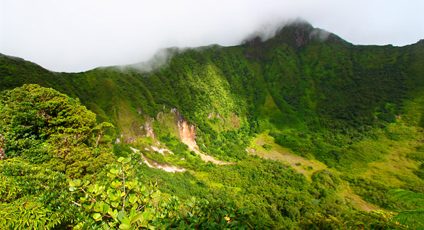
Mount Liamuiga is a long extinct volcano on the island of St. Kitts. It’s inner crater measures more than a mile across and 1,000 feet deep, and its slopes are now covered in rainforest foliage. Photo: St. Kitts Tourism Authority